Tributary No.1 – Un-named.

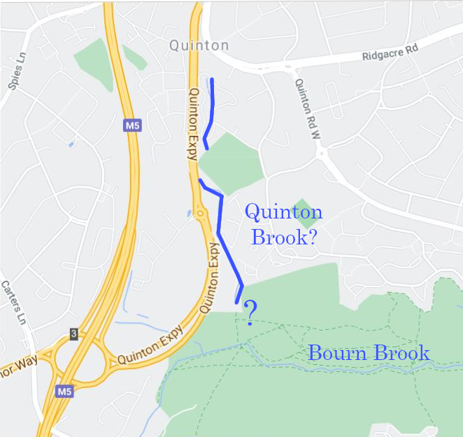
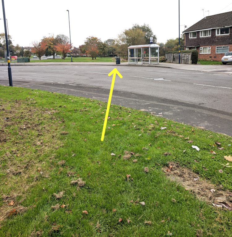
The exact source of the Bourn Brook isn’t obvious to me, though friends tell me that years ago, it ran down the side of Watery Lane, which was then unmetalled and very muddy. Since then it has been culverted, only emerging where shown at the foot of the above map. And after only about 550 yards in the open, it receives its first tributary. This has no name as far as I know, but can be seen culverted beneath the Quinton Expressway. However, reference to pre-motorway maps show that it was much longer…

Indeed, much longer than the infant Bourn Brook; I make it about 1100 yards long (almost exactly 1 Km).

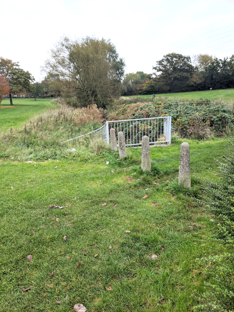
Very roughly shown above, it would have extended far past the M5. It may still exist there, of course, but culverted. I have put a red dot at the point where the footpath crosses the stream – images below.

Looking west – upstream. (To the M5.)
 Looking East. Downstream. Office chairs are heavy & clumsy things to move around. The one here would have had to be carted for well over 100 yards. Perhaps some high-level executive had it put there so that in idyllic summer weather they could sit out there in the lunch break & commune with Nature, thus being soothed & refreshed?

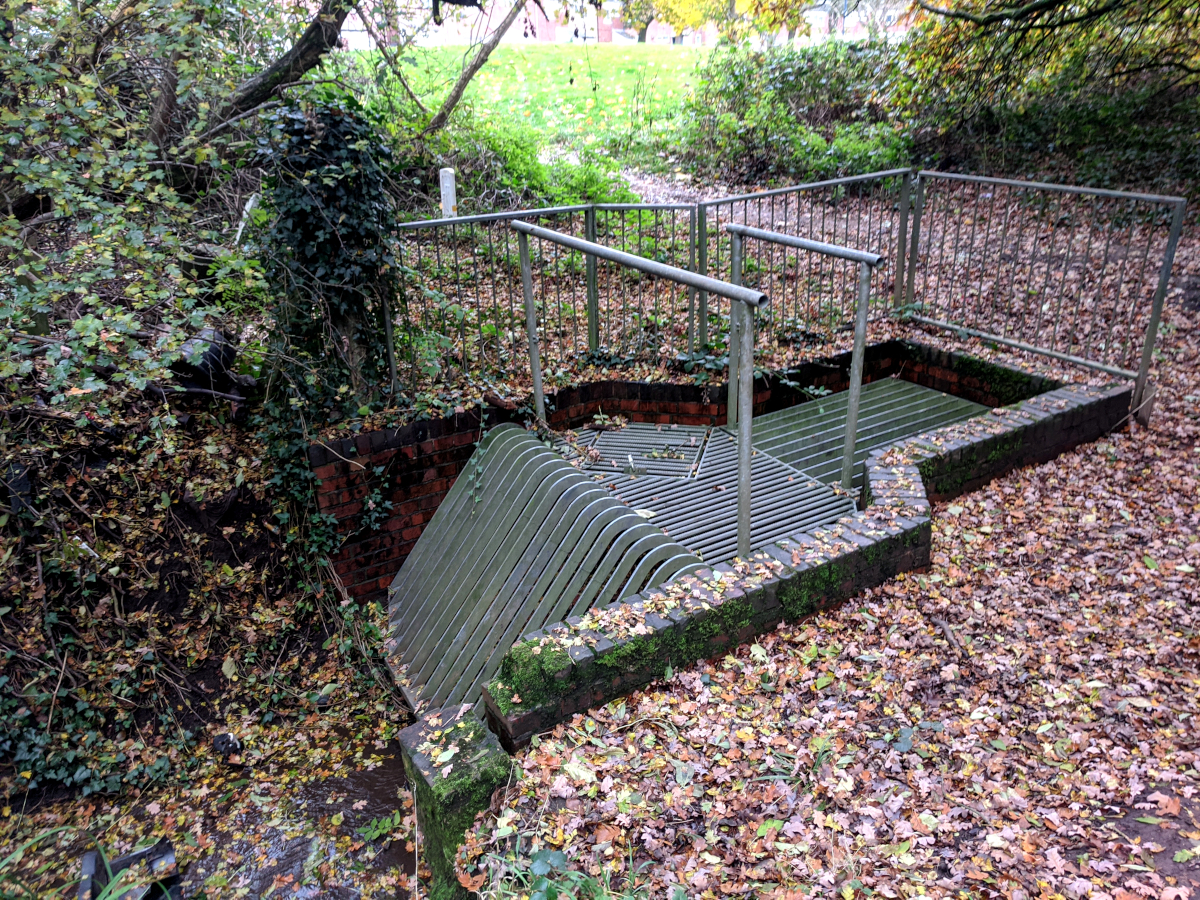
Notice the two ‘disjointed’ water features where it says Health & Safety. They are in water, or at least they are at the moment, but they are really static trenches, well populated by bullrushes (reed mace):

They have probably been deliberately contrived to give an alternative wetland habitat?
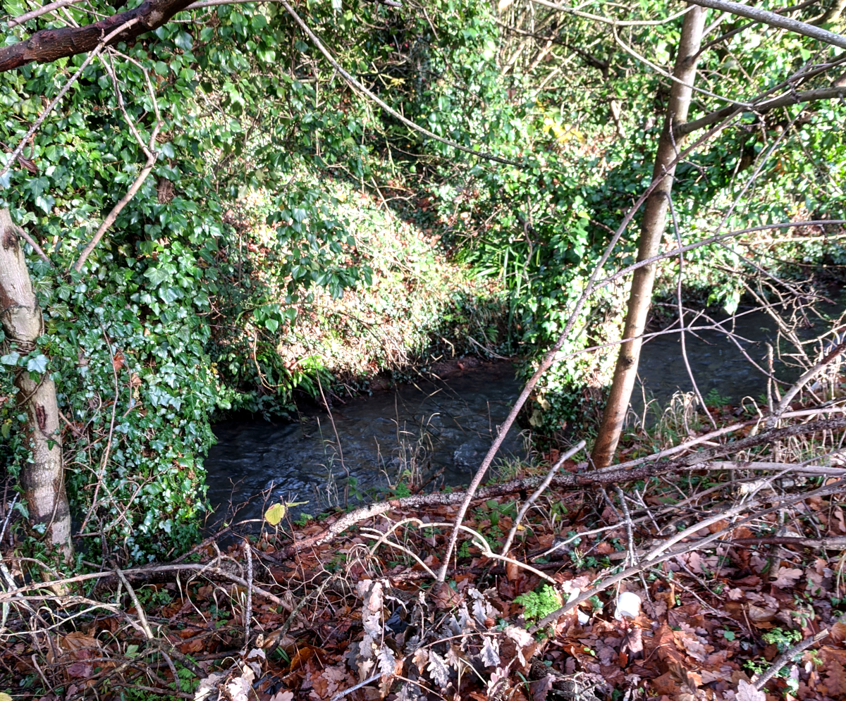
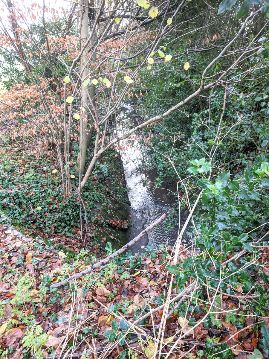
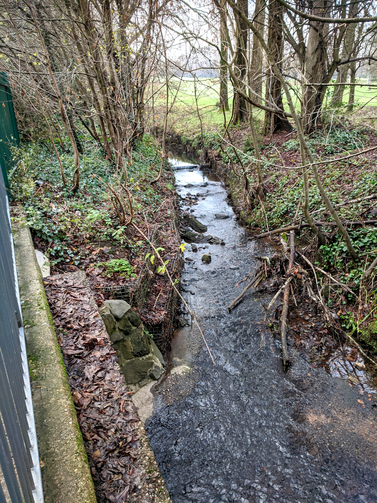
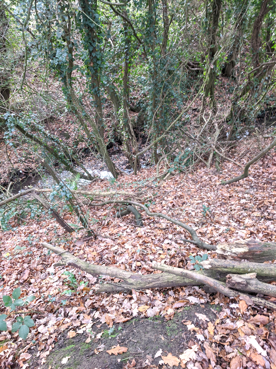 This is the stream going from right to left, soon after entering the Quinton Meadows from under the motorway plus two slip-roads. There’s nothing to give it scale, but it’s about 12 or 15 feet below where I am standing. It’s only about 2 or 3 feet wide, but there is quite a respectable flow in it. The spring where it originates must surely be going strong.
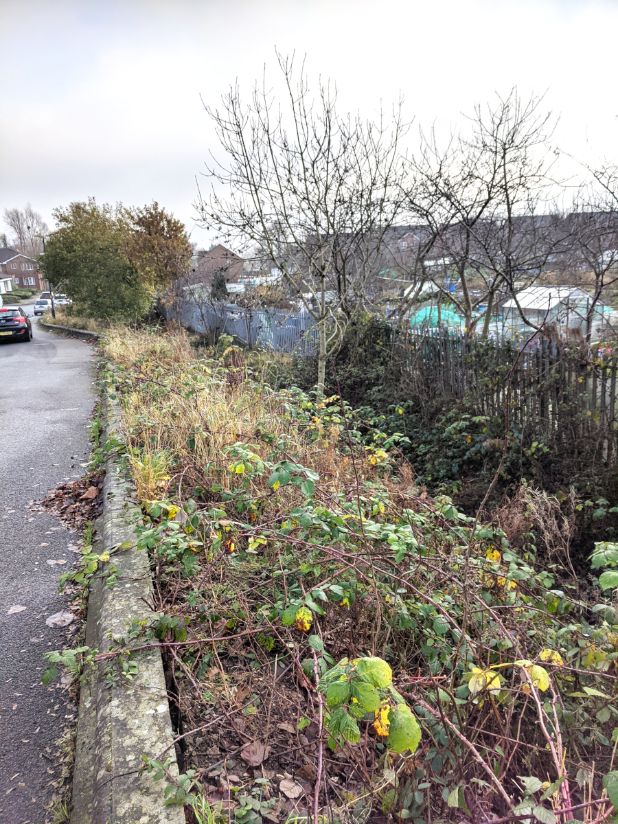
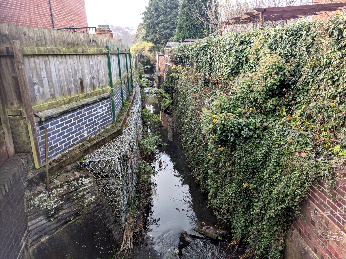
 I couldn’t get any nearer the M5 than this; the stream is hemmed in (as most of these streams are) by thick bushes, trees &c., & didn’t want to fall down into the deep channel! 8^) Actually, walking back, I kept a close eye on the course of the stream in its overgrowth, towards the expressway. I have been here many times – lots of blackberries – but have never specifically followed the path of the stream. It’s ‘valley’ really is amazingly deep, easily 20 feet, and it would be a very great hazard if you fell down it, or especially if I fell down it! It isn’t fenced as such, but the trees & bushes are an effective barrier to anyone except the foolhardy.
Tributary No.2 – The Quinton Brook?
Apparently originating in an area of Allotments and land marked on an old map as ‘Nurseries’, a small brook – which is not named on most maps – runs south, skirting the Highfield Lane Playing Field. The top section is not accessible, being in the allotments. If the map is to be trusted, it is briefly culverted at this point.

A path at the southern point of Highfield Playing Field, leads over the brook with a bridge.
 It’s not possible to follow the brook upstream, as the trees & shrubs form an impenetrable thicket!

But downstream, there is a broad path to the right of this shot.

A gas main goes under the brook.

To the right, beyond the trees, is the Quinton Expressway. There is housing to the left – this broad path is a tongue of land connecting Highfield with The Woodgate Valley Country Park.

Another bridge gives access to the residential area.
 Here begins the mystery! This barrier takes our little stream down into a culvert, but curiously, its empty bed continues as a dry channel, nearly as far as the Bourne Brook, before it peters out. It seems a waste of time to culvert a stream by excavating below the original bed, then restoring an empty channel? So the implication is, that the culvert goes off in another direction – but which? Because, the outflow of this culvert is not apparent on the north bank of the Bourn Brook – unless it is either very discreet, or possibly covered in vegetation. Hence the question mark in the map above. Tributary No. 2 seems to just disappear!
Tributary No. 3a – The Bartley Brook.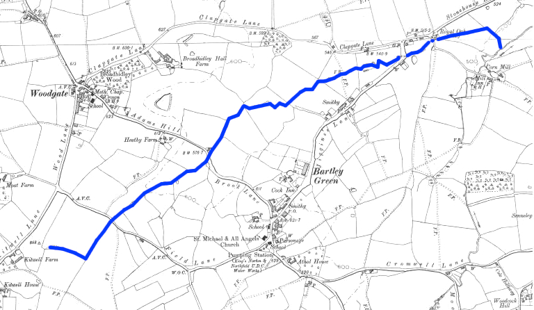 1.6 miles long, the source of the Bartley brook is in the south west of the above map. It’s on what was Kitwell Farm – now the site of a large Electricity sub-station. More interesting, is that Kit’s Well, marked ‘Chalybeate’ (bearing salts of Iron) on old maps, though only a few yards away from the source of the Bartley, flows west, while the Bartley flows east. Kitwell house is thus very much on the line of the Severn-Trent watershed.
 There was seemingly no access south of Adams Hill in Bartley Green. Here we’re
walking north-east,but looking back south-west. The Bartley Brook should
be off to the left; but tiny brooks & streams are often hard to find. 8^)

It’s late-ish October, as the leaves on the ground attest, but
it has generally been a good summer & is still a mild autumn.

Here we are. It’s only a couple of feet (~60cm) wide, and it has belatedly dawned on us
that we should carry a rod, say a metre long, which can be placed by things to give them some scale.

Here, the expected micro-tributary comes on from the west.
 It’s opened out into a large space – the path off to the left leads to Clapgate Lane. We go
straight on. 110 Kilovolt power lines pass overhead, doubtless having come
from the sub-station at Kitwell.
 The brook must now go under Jiggins Lane, so enters a culvert a few
yards short of Jiggins.
 Into the culvert…
The arrow marks the straight line across the lane, & into a grassy area.
which is the northern tip of Senneleys Park, of which much more anon!
The Bartley emerges into the open for a straight run…

Looking backwards at the end of this short open stretch, which requires
an elaborate barrier, as the brook is going quite a distance under housing.
Were any of the culverts to get blocked by tree branches, packs of twigs &
leaves &c, it would be very serious indeed!

We shall not see the Bartley Brook again; it enters this impressive barrier
& makes a culverted confluence with the Stonehouse Brook,
at a point roughly 310 yards (~ 287 metres) away, all underground.
Tributary 3b – The Stonehouse Brook.
 We have been using these old 6″ maps (Courtesy of the National Library of Scotland) because they date to the late 1800s & early 1900s, when Birmingham was much smaller than it now is, and streams are easier to follow. But in this case, the topography has changed beyond recognition. It is not even certain that all of this watercourse was called the Stonehouse Brook (I make many mistakes 8^) , but it essentially travels north east. It arose in Bromwich Wood, and essentially followed a shallow (presumably glacial) valley, until, near the centre of the image, it crosses Cromwell Lane and traverses Sennelys Farm – now Sennelys Park. Housing has been built on practically all of this area. Just out of this map to the south, is Frankley Reservoir. This was created in the late 1890s to receive a water supply from the Elan Valley reservoirs, 73 miles away in Wales. It worked well, but it was later decided to build a second reservoir to hold perhaps a week’s supply of water, should maintenance work on the pipeline become necessary. It opened around 1930, and occupied a large part of the valley just described. Look:
 As you can clearly see, most of Bromwich Wood has disappeared under the new Bartley Green Reservoir – yet the Ghost of the Bromwich Wood Brook (if that’s what is was called) has been suffered to still emerge out of the dam at the north eastern face of the reservoir. This then proceeds as it always had, presumably since the end of the last Ice Age (what, 12,000 years ago?) up into what was Senneleys Farm, but is now Senneleys Park. And yet, the blue trace of the original brook is completely wrong! We need to examine the evolution of the mini-waterways of Senneleys more closeley…
 We simply couldn’t work out what was going on; there seemed to be too many streams. In addition, we found a culvert in some trees (shown by the red dot), where a spring came out from under recently-built houses. At last we found a notice board with a map of the park! The brook entered at the south, which it still does, and runs north, but it originally bore left, and ran into a marshy area fed also by the ‘red dot’ spring. It then flowed north again, pretty much as it does now, passing to the left of the clump of trees, centre top, where the corn mill was, naturally with its mill pond. At some point, it was decided to drain the marshy area, so the main stream coming north was given a new channel, partly culverted, and running along the right of the trees, centre top. In addition, the two streams were joined by a short culvert – for what purpose is not obvious to us.
Having got that lot out of the way, we can simply have a series of photos stage by stage from the Reservoir!
 Looking along the dam – Genners Lane already existed but had to be straightened.
 It was a very dull day, and the view across the reservoir is not very inspiring. And yet – there is history all over the place – take that big clump of trees on the skyline. It’s Frankley Beeches, the district giving its name to the M5 service area, which is not very interesting to be sure; but if, like me, you are interested in the history of radio… Marconi made tests from Frankley Beeches in the early 1920s, beaming then advanced ‘VHF’ signals down to Bristol, for you have line-of-sight from that hill, far to the south west. Bristol is just under 80 miles away as the crow flies, or the VHF beam aerial directs! 8^)
 By way of variety, here is a reciprocal zoom shot – from the top of Frankley Beeches, back across the reservoir, the dam on the far side, and on a nice summer’s day! The reservoir itself was part of the ambitious Elan Valley Scheme, to build dams in Wales & lay a 73-mile-long (117 Km) pipeline to supply Birmingham with water, (I keep saying this, sorry!) but a good deal of the West Midlands conurbation is actually quite high up, peaking at just over 1000 ft a.s.l. at Walton Hill, Clent, not far from here. Most of Brum itself is between 500 – 600 ft a.s.l. So the water supply is meagre… Construction of the pipeline began in 1896, and it was opened by King Edward VII in 1904, initially using the nearby, smaller, Frankley Reservoir.
 Behind the dam – which is not very tall – though I read that the
Bartley Green reservoir is up to 60 feet deep!
 There is no access to the dam area, but a line of tree mark the point at which the
brook emerges from a culvert, traverses the ground to Moors Lane.
 The ‘Stream That Has No Name’ (which I refuse to believe), enters its
splendidly-appointed barrier….
 … and after crossing Moors Lane & Cromwell Lane, emerges in Sennelys Park.
 Flowing north.
 One of several bridges.
 Here, the original stream is split two ways, into culverts.
 The right-hand branch (the new one) is now in the open & approaching Corn Mill Close
 It is re-culverted and runs underneath Corn Mill Close.
 Remember the Red Dot? We’ve gone back down there, and you see the culvert
which emerges from under new housing…
 An Arum Lily fruit cluster adjacent – they like damp places!
 Looking upstream on the new, western brook – still small.
 Right: the western brook emerges from a short culvert.
Left: is the link from the eastern brook.
 This Western arm, remember, was the original stream bed. Very pleased to see
water plants growing! Mostly, of course, these small brooks are shaded out
by trees & shrubs, so there’s not enough light for plants.
 The western arm goes under Mill Lane. The two then join up, underground.
 All the housing around here is very recent, except this one. It’s the only relic of the days
when the watermill was here, with its Beer House – this was the Mill Inn.
 This gothic arch brickwork is typical of the 1840s.
 The two brooks meet under this grassy area, which has been left open,
in case it ever has to be dug up to repair the culvert. Clever, eh? 8^)
 And at the far end of that grassy avenue, there is another space that has not been built on – that’s the arrow on the left. Because somewhere under there, the now-combined brooks of Sennelys Park have their confluence with the Bartley Brook, which as we remarked, has travelled somewhat over 300 yards in its culvert, for that very purpose. Really clever stuff! Please can we go home now? Alas, not quite. Because, you see, there’s the other arrow, further away.
 Yes – the Stonehouse Brook continues on the other side of these railings,
into the little-known bit of the Woodgate Valley Country Park that is
on the south side of Stonehouse Lane. Little-known to me, that is, until today.
 There are actually quite a few paths in this woodland but I didn’t know that, and
walked along Middle Acre Road until I found this one.
 Downstream is densely overgrown.
 Upstream is OK, and there’s a very big building looming up –
the Barnes Hill ASDA superstore. Wow!
 Back up to Middle Acre Road we go.
 This is when I discovered this woodland was a part of Woodgate Valley Park.
 The brook has been slightly diverted, to go round the top
of the giant ASDA Superstore.
 Here is a giant, ultra-de-luxe filter barrier! It was certainly worth
walking a couple of miles to see such a great piece of work.
I have driven past it many times, but had no idea it was there.

This reminds us that this area was intensively developed in the mid-19th Century
as Brickworks, conveniently by the side of the Lapal Canal. But California
(named after the 1849 U.S. Gold Rush) deserves a web page all to itself!

Looking back to ASDA. The Brook continues under the
row of houses you can just see on the right.

Turning 180°, we see the parapet of the Stonehouse emerging into the open again.

Downstream, plus excellent advice for Covid 19 times! 8^)
 We’re nearly there! The culverts are yellow.
 1. At first the Stonehouse hugs Stonebrook Way.
 2. There’s a council depot and offices – inaccessible, but the stream seems to
stay in the open as it passes through the place.
 3. This district is called Weoley Castle, after a moated & fortified mediaeval
manor house. Naturally, the brook kept the moat topped up, and having done so,
carried on its way. See: https://www.birminghammuseums.org.uk/weoley
 4. The site is of course currently closed.
 5. But I was lucky to meet two custodians who arrived to check security, who told me the had been a plague of chafer beetles, the larvae of which eat the roots of the grass, which then, rather naturally dies. To made matters worse, beetles and their larvae attract foxes & badgers, who dig the place up. Incidentally this photo was taken at 1136 – noon is just 24 minutes away, and the length of the shadows reminds us that it’s only a couple of weeks to the Winter Solstice. Brrr.

6. The path of the culvert through Weoley Castle is partly conjectural, but it emerges on the east side of Bottetourt Road. (Several of the roads around here are named after ancient land-owners; Joan de Botetourt had half of this barony in 1322.)
 7. Looking upstream – that is, south – and the low sun shines
through the largely bare trees.
 8. Downstream is largely blotted out by lush vegetation.

9.There is no access to the brook for the next 250 metres, but the map shows it in open air, apart from when
passing beneath two roads. Here, it emerges from the second of them,
and it’s now only 125 metres to the Bourn Brook.

10. At last! The Stonehouse Brook enters the Bourn Brook, the shot taken from the
north bank of the Bourn Brook. When I ‘did’ the Bourne Brook, I missed this confluence,
because the path is rather far from the streams.
Tributary Nos. 4a & 4b – The Hart’s Green Brook & Welshes Brook.
 Again, the groups of images are numbered. Yellow: culverts; blue: open-air.

1. This is a patch of land facing onto Tennal Lane, now on the border of of Harborne & Quinton. To the right, used to be Tennal Hall. Before then, there was a previous building or even a small settlement? It’s not known why it was called Tennal Hall. A family called Pearman lived there for ~300 years, until they died out in the later 1920s. Then, the City of Birmingham purchased the estate for housing development of ‘Council Houses’ – rentable, municipal housing. Many of the houses were built around 1930. They were very well built – I know because I live in one! – and I’ve often thought that the people who arrived here from inner-city back-to-back slums must have thought they had moved to a Paradise… But why are we here? Because where the brownish grass can be seen in the centre distance, there was a pond in front of Tennal Hall; and it was the source of a small stream that ran off, towards the bottom left of the image.
 2. On the other side of the road, is the appropriately named Brook Lane, which as you can see, runs downhill.
 3. On the right of Brook Lane are allotments, but the brook runs down the western edge of them, in between the kerb and the metal fencing. It is really quite a small brook, even by Birmingham standards.
 4. After 100 yards or so, it disappears under new housing. Very new housing; which implies that the brook has been culverted, in order to free up land for building speculators. I wasn’t able to find any surface features of this brook (though they may exist), so we must assume that much if not all of this brook is underground until Northfield Road.
 5. It appears to be culverted for much of its further course, and certainly as it passes over the north-east part of the Harborne Golf Club’s course. One interesting local feature here, is that the Golf Club, which dates from the 1890s, has in its coat of arms, the Staffordshire Knot – which reminds us, that at that time, Harborne was in Staffordshire. Later, it was in Warwickshire, let alone now, in the West Midlands. But mainly, it emerges from the Harborne Golf Club, and needs to cross Northfield Road. I am quite certain that it does so, flowing south, towards us, underneath this builders yard, where the 19th century houses have left a space.
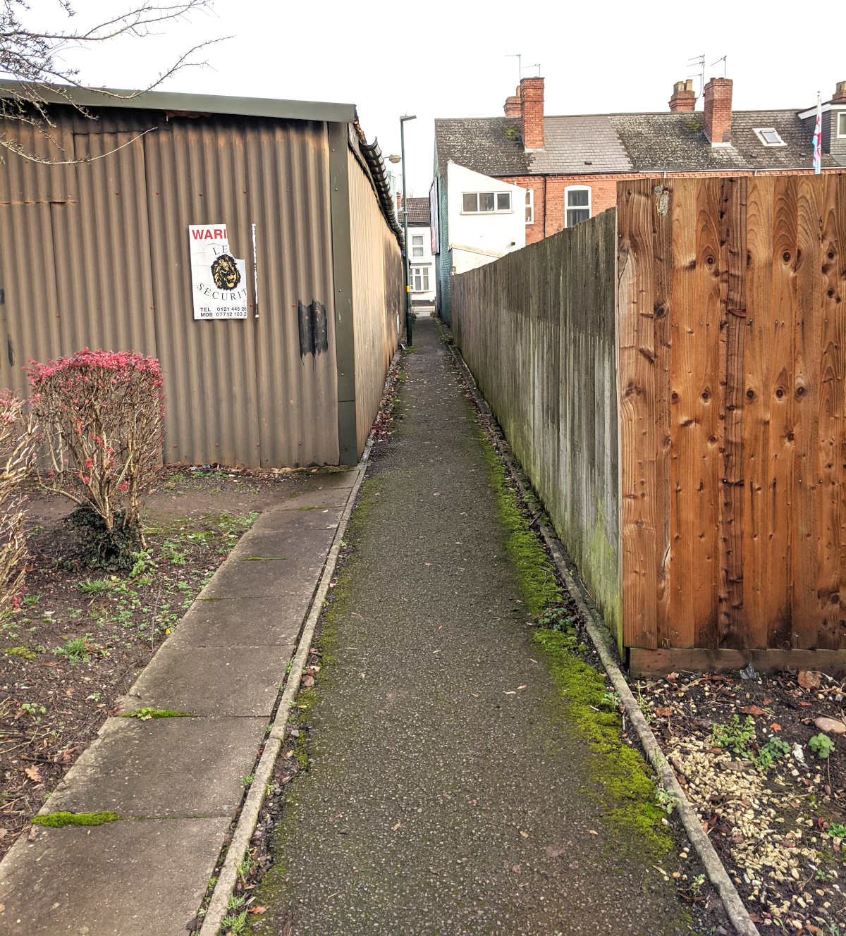 6. There is a right of way, leading to the rear of that builder’s yard.
Here, we’re looking back to Northfield Road.
 7. But if we turn around and look north, we see a large empty space, flanked by rows of garages. Yet again, we see the careful work of civil engineers, who have insisted that there be open access to the culvert in case it need repair; but equally, remains functional as a ‘garage yard’. Unquestionably, the Hart’s Green brook flows south, beneath us, at this point.
 8. On the other side of the road, terrace houses were built over the Brook. I calculate
the Brook goes slap-bang equally between these two houses.
 9. This is one of the ‘forgotten byways;’ of Harborne, south of Northfield Road,
and it is here that a very short stream flows into the Hart’s Green Brook…
 10. This concrete plinth & manhole cover probably represent where the main brook, & its tiny
tributary, join before flowing into the Municipal 9-hole Golf Course. The metal cabinet
has a notice by Severn Trent Water, requesting reports if any pollution occurs.
 11. Anyway, here we are! The Hart’s Green Brook, small as it is, flows
peacefully into the Municipal Golf Course.
 12. Very easy to miss, this gate! On trips around the area, making this intolerably long page, we drove along this road a score of times, always keeping watch for any sign of Welshes Brook. Seemingly culverted for its first three-quarters of a mile, it flows openly across Harborne Golf Club; at least nine bridges can be seen over it in satellite view – which is how we pin-pointed the place where it crosses Northfield Road.
 13. It looks very attractive, even on a cold day (max temp was only 3.7°C),
almost as if it were some ‘designer water feature’!

14. As for the south side of the road, facing onto the Municipal Golf Course, there is nothing whatever visible; except for a curious redundant (?) concrete ramp. Why? Perhaps it was left over from the landscaping of the Golf Course, so that lorries, or even horses & carts, could bring stuff in & out?
 15. However, when one offers up one’s camera to the wire netting, all is reassuring. Welches Brook emerges from a black brick parapet, and flows off to the south-west. Two bridges over it are visible. One cannot help wondering how many golf balls per month go into the Brook, on both sides of Northfield Road!
 16. We’re now on the other side of the Municipal Course, and it’s time
for the two brooks to unite. Here, from the south, is Welches Brook.
 17. And here comes the Hart’s Green Brook from the north side. They meet
and flow out of the lower right of the image. Hart’s Green wins the title!
 18. A nice stone border runs very straight to start with then gently curves
between housing for nearly a quarter of a mile, down to Quinton Road.
 19. The end of this well- constructed section, seen through railings
as it disappears into a culvert to run under Quinton Road.
 20. The culvert is about 250 yards long, and passes beneath a considerable private housing estate.

21. And at long length, in comes the Hart’s Green Brook from the top,
and joins the Bourn Brook, which enters from the left of the image.
That is the end of this web-page; it’s dragged on for plenty long enough. 8^)
Congratulations – you have been very patient! You may either pleased
or dismayed, to discover there is one final tributary to the Bourn Brook
– indeed, the longest, at 3 miles, as against 4.5 miles for the Bourn Brook itself.
That is the Chad Brook, and has already been dealt with on its own page.
To go there, click here.
And there is, of course, a page devoted to the Bourn Brook itself!
To go to it, click here.
Wishing you a Merry Christmas, for it is already 8th December.
Help Beat the Covid Pandemic! Stay Safe!
Page started 24th November; finished 8th December 2020.